(Note:
Some of you have noted that for a blog on Southern Africa, there seems to be a
lot about Frankfurt, which is at least somewhat true.
1)
It seems like a lot because you all want to see Southern Africa.
2)
I have this annoying habit of dividing each day into 2 or 3 postings. For that I can only say, guilty. And you will have many more posts on Southern
Africa than on Frankfurt.
3)
I do believe that all things are interconnected. The support of some of the pro-Apartheid
leaders in South Africa for Nazi Germany is an important part of the history of
the struggle for democracy in South Africa.
And the next two postings after this one – which complete the section on
Frankfurt – contain some about Nazi Germany.
4)
I admit to being a completist. These photos were all taken on the same trip.
At the end there will be material on our week in London. This too will contain material relevant to
the South Africa part of the discussion.
5)
If you really don’t want to read the posts on Frankfurt, please feel free to
just delete or skip. My feelings won’t
be hurt – and I won’t know in any case.
The first post from South Africa will be posted on Feb. 28 although the
post on Feb. 25 includes discussion of the trip from Frankfurt to Johannesburg
via Munich (Airport).)
As
I’ve noted, Frankfurt is divided geographically into north and south sections,
bisected by the Main River which flows east/west. The divide is
reflected in many differences between the two parts . North of the river
is the city center, and all the new financial and other skyscrapers as well as
the trade fair section. It was the part of the city that was
significantly damaged by bombing in World War II. The south part of the
city is known as Sachsenhausen which I was told means Saxon
housing although I haven’t been able to confirm this The south section
has very narrow, winding streets and older houses which were not the subject of
war bombing. It also seemed more rural.
The
area along both banks of the Main river are significantly green and either
recreational or cultural. Many of the museums of Frankfurt are strung
along the river. Here is one section of both sides of the river as
seen from the tour boat.
Here
is a view of the north side of the river in an area with very little green
along the north shore, which does have less green than the south shore.
 |
| North Side of River with Little Green |
And
a view of the north side with a bigger green buffer between the buildings and
the river.
 |
| North Side of Rive with More Green |
There
is also some art work along the river that at least pays some homage to
the fact that it is on a body of water.
 |
| Art Work Along River |
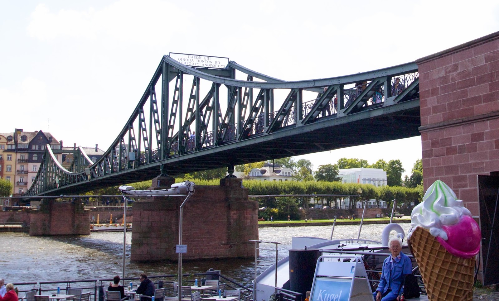
As
to be expected of a river flowing through a major city, there are a number of
bridge crossings. Some are fairly old and seem of utilitarian design,
although I leave to others to explain both the meaning of the apparently Greek
sign on the first tower and the reason that there is a sign in Greek on a
bridge in a German city.
 |
| Old Bridge with Greek Lettering |
This
is a somewhat less ancient bridge but the design is very interesting and
extends to the piers of the bridge.
 |
| Less Ancient Bridge |
And
this fairly modern footbridge, vaguely reminiscent of the Jubilee Footbridge on the Thames.
 |
| Modern Footbridge |
After
getting off the river, we visited the Frankfurt City Museum, the subject of the next post. It was an interesting
insight into the people of the city including what happened during World War
II. Remember, I did say it’s all
connected.
Link to Full Resolution Photos
Link to Full Resolution Photos

No comments:
Post a Comment